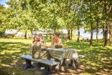
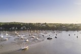
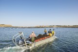
De la Vilaine aux bouchots
 Itinéraire Vélo de ville
 Départ : Férel
 Arrivée : Pénestin

 ITINERAIRE_DEPART_ARRIVEE
 ITINERAIRE_POINT_INTERETS
Circuit n° 1
- Praktische Informationen :
") Durée (à vélo) 2h00
Durée (à vélo) 2h00 Länge: 25 km
 Abfahrts-Ort Férel
 Ankunfts-Ort Pénestin
 Zugang: Quai Saint-Antoine à la Roche-Bernard
 Strecke markiert in Balises vélo
Download
- PDF_Topoguide VELO Les Belles échappées_Fiche n°1_De la Vilaine aux bouchots-LRB_Férel_Camoël_Pénestin (5.37 Mo)
- PDF_From The river Vilaine to the mussel farms_descriptive sheet_Eng (2 Mo)
- PDF_Radtour - Von der Vilaine bis zu den Bouchot Muscheln (1.99 Mo)
- GPX_Fiche n°1_De la Vilaine aux bouchots (162.01 Ko)
- PDF_Cycling Topoguide Beautifull Escape_File n°1_From the Vilaine to the bouchots (46.29 Mo)
- PDF_Cycling Topoguide Beautifull Escape_File n°1_From the Vilaine to the bouchots (45.69 Mo)