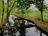
La chalandière et le Brivet
 ,
,  ,
,  Itinéraire VTC ou VTT
 Départ : Besné
 Arrivée : Besné

 ITINERAIRE_DEPART_ARRIVEE
 ITINERAIRE_POINT_INTERETS
Circuit n° 1
Circuit n° 2
- Praktische Informationen :
") Geschätzte Dauer (für eine Geschwindigkeit von 4 km/h) 2h15
Geschätzte Dauer (für eine Geschwindigkeit von 4 km/h) 2h15 Länge: 8.8 km
 Abfahrts-Ort Besné
 Ankunfts-Ort Besné
 Zugang: Aire de pique-nique de La Gériais
 Strecke markiert in Jaune

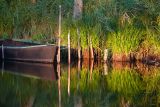
Point 1 - Le canal de la Joue
BESNE
BESNE

Point 2 - La Chapelle Saint Second
BESNE
BESNE

Point 3 - Prairies humides le long du Brivet
BESNE
BESNE
Download
- PDF_Topoguide RANDO_Fiche n°16_La chalandière et le Brivet_Besné (539.9 Ko)
- Trace GPX_La chalandière et le Brivet_Besné (8.44 Ko)
- Trace GPX_La chalandière et le Brivet_Variante chasse_Besné (839 o)
- PDF_Hiking Topoguide Beautifull escape_File n16_Exploration of the Besné marshland (La Chalandière & Le Brivet) (22.12 Mo)
- PDF_Wander-Topoführer Schöne Wanderausfluge_Datei Nr16_Chalandière und Brivet (22.13 Mo)