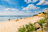
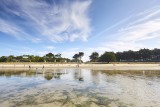
Du port de Tréhiguier à la Pointe de Pen Bé
 Itinéraire Vélo de ville
 Départ : Pénestin
 Arrivée : Assérac

 ITINERAIRE_DEPART_ARRIVEE
 ITINERAIRE_POINT_INTERETS
Circuit n° 1
- Praktische Informationen :
") Durée (à vélo) 1h45
Durée (à vélo) 1h45 Länge: 23 km
 Abfahrts-Ort Pénestin
 Ankunfts-Ort Assérac
 Zugang: Port de Tréhiguier, baie de Pont - Mahé
 Strecke markiert in Balises vélo
Download
- PDF_Topoguide VELO Les Belles échappées_Fiche n°2 _Du port de tréhiguier à la pointe de Pen Bé_Pénestin_Assérac (3.69 Mo)
- PDF_Radtour - Vom Hafen Tréhiguier bis zur Bucht von Pont-Mahé (2.08 Mo)
- GPX_Fiche n°2_Du port de Tréhiguier à la baie de Pont-Mahé (133.2 Ko)
- PDF_Radfahren Topoguide Schone Wanderausfluge_Datei-nr2_Vom hafen Tréhiguier bis zur Pen-Bé andspitze (24.82 Mo)
- PDF_Cycling Topoguide Beautifull Escape_File n°2_From the port of Tréhiguier to the Pen-Be headland (24.81 Mo)